Hopefully, that title is descriptive enough:
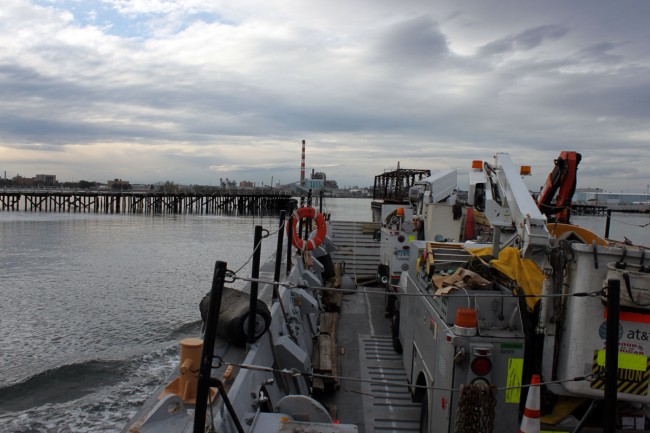
We loaded a couple of ATT bucket trucks on a landing craft and waged an assault on Pleasure Beach. This is to finalize the repair work from Hurricane Sandy last year. The other factor is the construction taking place on the Island. The City of Bridgeport is constructing a park, which involves extensive repairs and renovations to the buildings. Construction vehicles driving under the old lines have ripped them down several times, thus repairing the lines on the new utility poles was necessary.
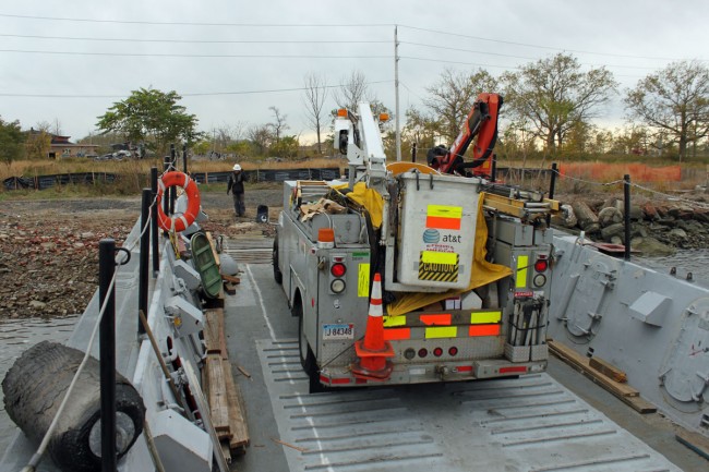
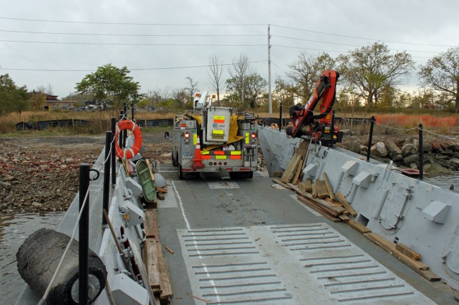
ATT is the LEC for the Bridgeport area, something they don’t do in most other parts of the country, from what I am told.
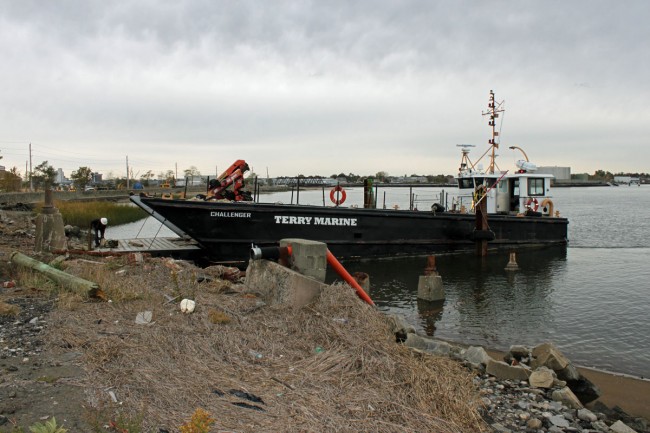
It took approximately four hours to complete this work and reload the trucks back on the landing craft. The boat itself looks like a slightly modified LCM (Landing Craft, Mechanized), which was produced from 1943 onward. This is an LCM-8.
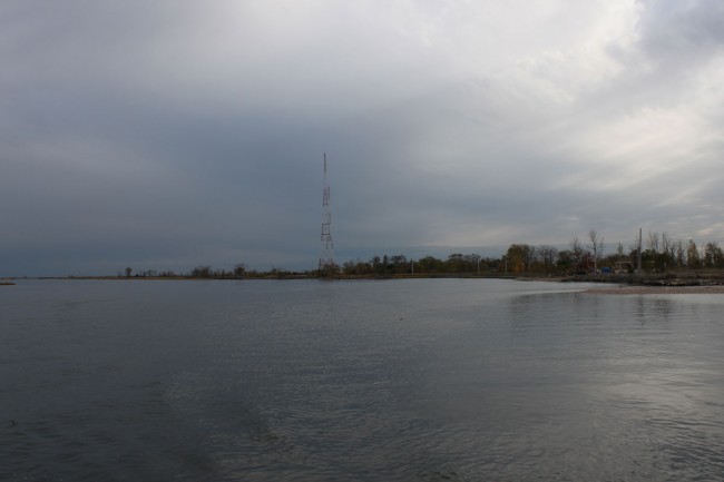
WICC towers almost in line, I was about one second too late with this shot. This would be “down the bore” of the daytime pattern into downtown Bridgeport.
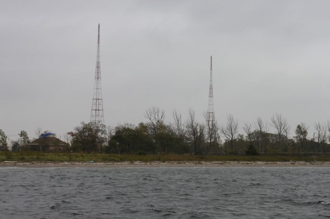
Another shot of the WICC towers. These were designed to hold up a horizontal T top wire antenna strung between the two of them. At some point in the early thirties, somebody realized that the tower itself could be excited as a vertical radiator and the antenna configuration was changed. Up until the mid-1970s there was a horizontal wire which supported a third wire element hanging between the two towers, making it a three-tower directional array. This was removed and it was then that the current phasor and two-tower DA-2 system was installed.
All in a day’s work.




Does the park and renovation mean there will also be a real roadway and usable bridge leading to the island, or will it still be boat-only (or low-tide-walking) access?
Not a chance for cars – the Finch regime is still working the ‘water taxi’ scheme (with gov’t money. $5 mil? half from US gov’t – it was all for $1.9mil back in 2009) for two 30-seat boats.
I could figure a rebuilt bridge would have cost less, carried more people/cars, wouldn’t use fuel, be immune to the tides, and wouldn’t demand as high a fee as a boat trip, but that’s just rational thinking talking.
And, as far as walking, as far as I know, if you’re caught out there now you’re trespassing.
The bridge burned June 16th, 1996.
A recent article: http://www.ctpost.com/local/article/Water-taxies-to-bring-Bridgeport-back-to-the-beach-4323864.php
Bob, no bridge, it will be by water taxi and walking access from Stratford.
Do you have any radials in the water? One of mine did at one time…. I’m pondering practical means of putting some in.
Andy, no radials in the water, but according to the old site plan, they go right up to the water’s edge. Most of the radials are truncated, at 600 KHz a 1/4 wave is over 400 feet long
Paul,
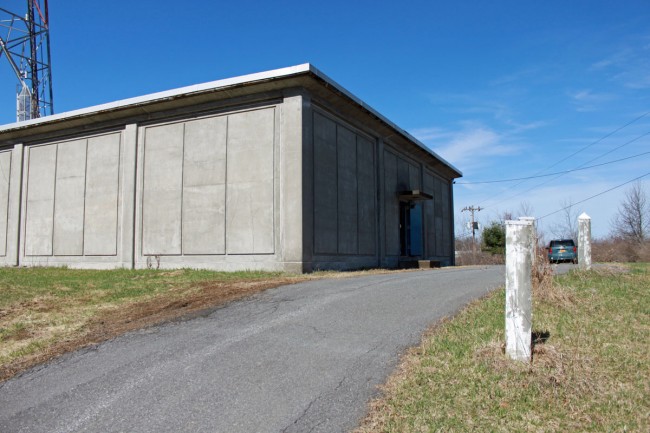
Can you comment on the type of antenna shown in the picture? The two towers very close and attached at the top look like a directional array similar to the horizontal third element you mention in this post. Does the third tower (with cell and horn antennas) have anything to do with this or is it electrically “invisible”?
http://www.hfunderground.com/board/index.php/topic,13630.0.html
Thanks for your blog. Always interesting.
Zane
That is an interesting photograph. The closest tower has a 2 bay FM antenna near the top, above that are some VHF or UHF whip antennas, likely two way radio. There is a cell site and a couple of microwave dishes and between the cell provider and the FM antenna are some WIFI antennas.
As for the two towers tied together; they do not have base insulators, skirt wires and the guy wires are not broken up (in non-resonant lengths) by insulators. Thus it is not MF or HF. Guessing by the “house” type building, this probably started out as an FM transmitter site. The station owners decided to make some extra money leasing out tower space to paging and two way companies. At one time, that cross section was probably filled with those type antennas. Since commercial two way (excepting government e.g. 911 dispatch, highway department, etc) and paging have all but disappeared, the antennas were removed leaving the mostly empty towers still standing. The fact that they straddle the house would make it very difficult to take them down.
That is my guess.
That looks like an old cable TV tower. Back in the day when cable systems used off air pickup, the antennas would be mounted on the horizontal bridge which also included a cat walk making it easy for the workers to mount and aim them. There are still a few of these on Long Island, most of them now devoid of TV yagis likre the one pictured here. Some of them had as many as three bridges. I imagine that the physics of constructing one of these and maintaining plumb and tension must be a bit tricky.
Paul, you could be right, but most cable head ends have a few extra satellite dishes kicking around, especially those old “simulsat” dishes designed to look at several birds at once. Not a bad idea in theory, until the 1 degree spacing came along…
I am so glad to see the Challenger is working again. I was the engineer on the crew that brought her down the NY state canal system and the Hudson river from the 1000 islands, in November of 2014. we were the last boat thru the locks that year. It was interesting to know and see the that the locks were being laid up for the winter. In a couple of instances, the maintenance crew was stand by waiting for us to leave the basin so the could put the coffer dam in place.
It’s good for old sailors to stay busy. good luck with her.
PS
I must add that of all the vessels that I have been onboard, the Challenger was by far the cleanest and best care for.