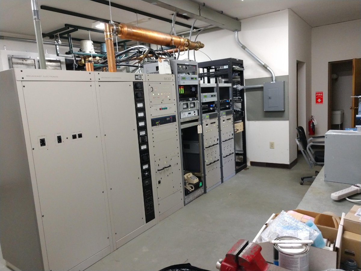
Finishing up a transmitter site rehab. The BE FM20T is nearly 20 years old. The BE FM2C transmitters are new. There is also a rack of new fiber equipment and CODECs. This site has good utilization; there are three stations on one tower with a shared STL antenna and generator.
Energy Onix ECO-6
Energy Onix ECO-6 tube-type transmitter. One of Bernie’s better designs; a grounded grid tube with a solid-state driver section. This one needed some fans replaced and a new tube.
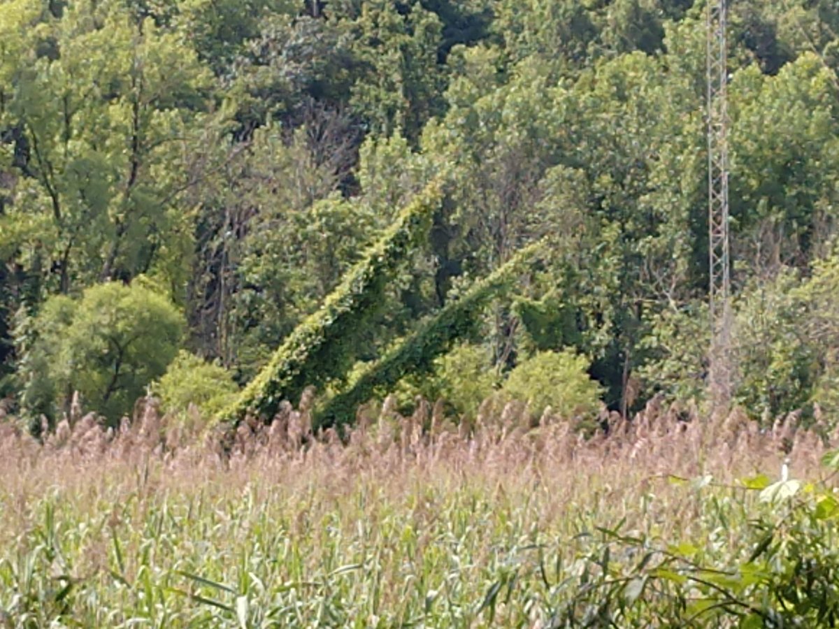
AM transmitter site. Looks like these vines have not been cut in a couple of years.
I wonder how much the guy tensions have changed…
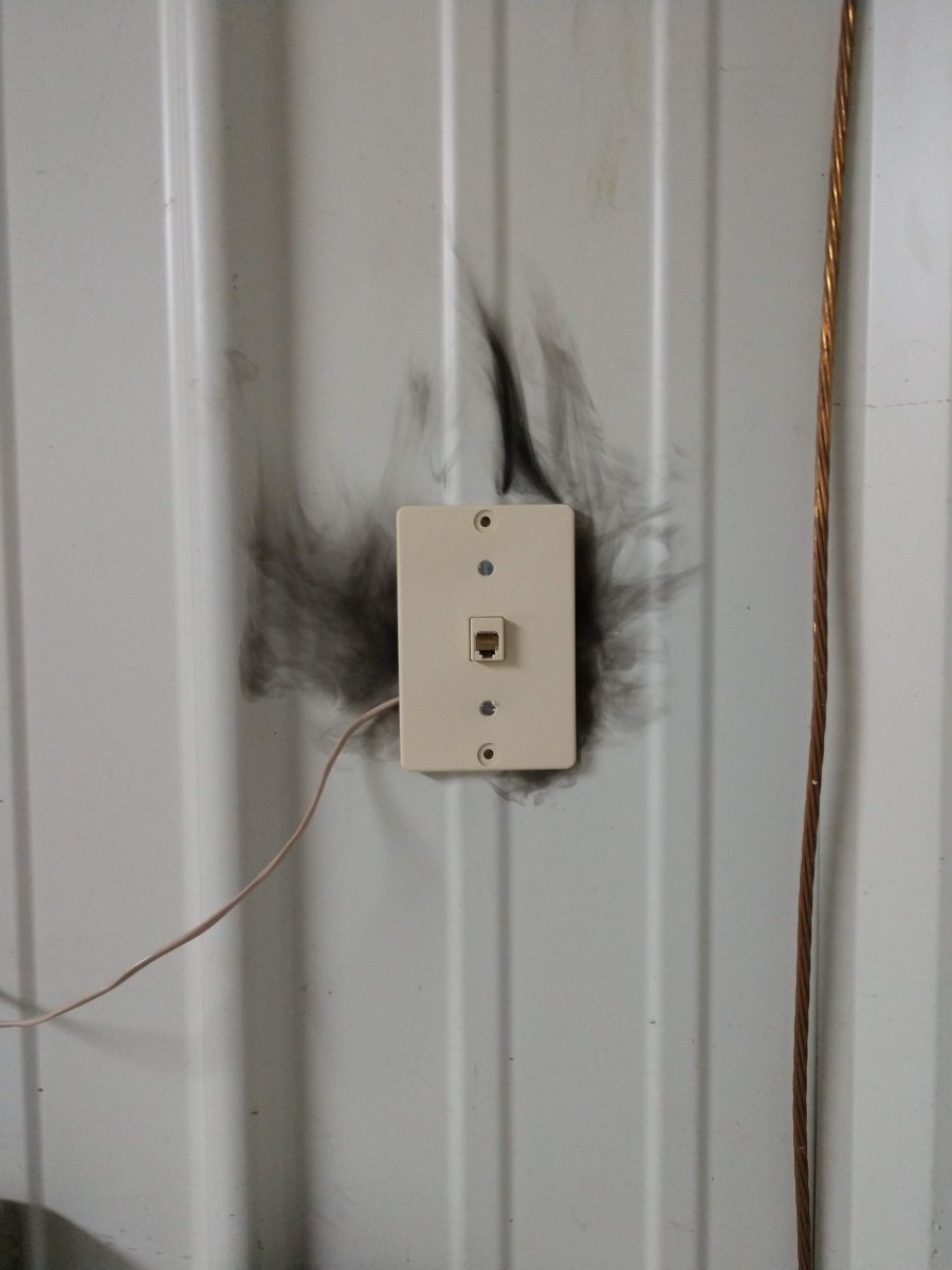
Noticed this after some particularly strong thunderstorms
The reason why you do not use a POTS line phone during a thunderstorm.
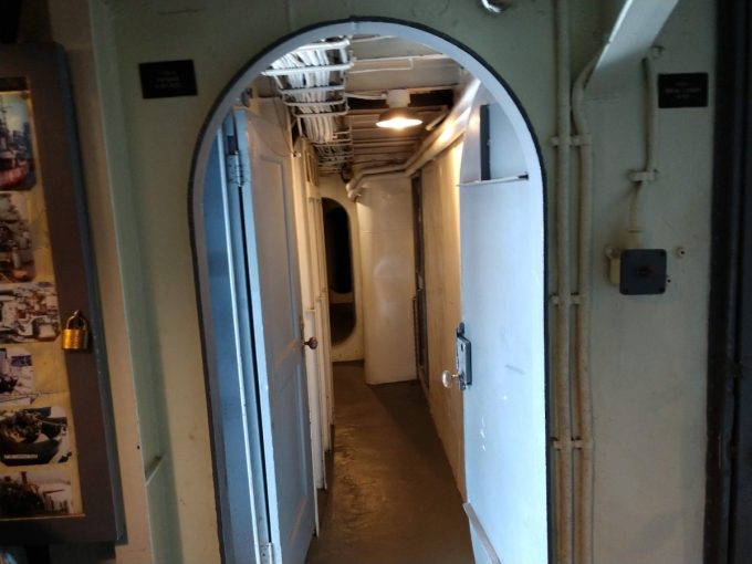
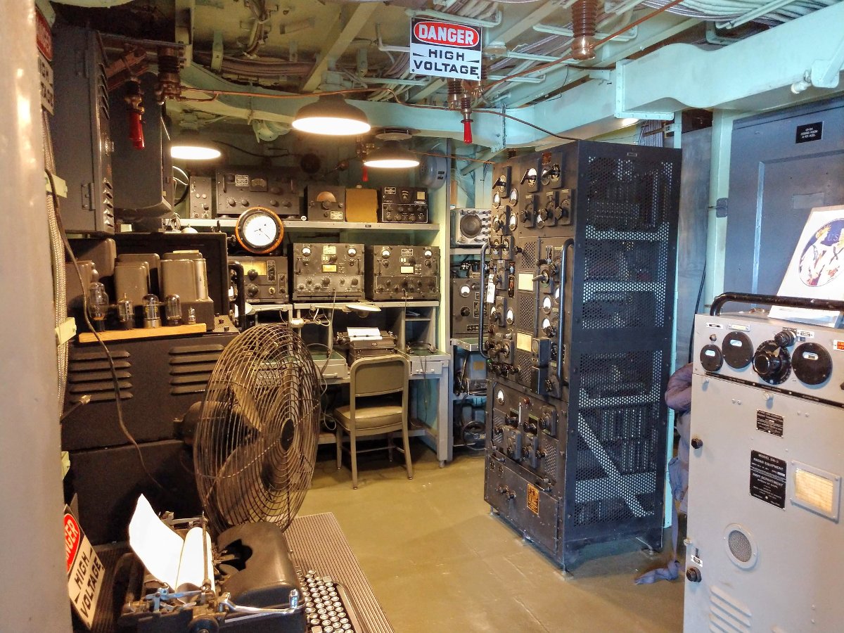
USS Slater radio room
I took a tour of the USS Slater, a museum ship in Albany, NY. The museum has painstakingly restored the ship to its WWII configuration. The main transmitter is the RCA TBL-8 seen in the left/center of this picture. This unit put out 200 to 400 watts CW or 150 watts AM phone. During the hostilities, it was turned off as allied ships observed radio silence unless they were sinking (and sometimes even then).
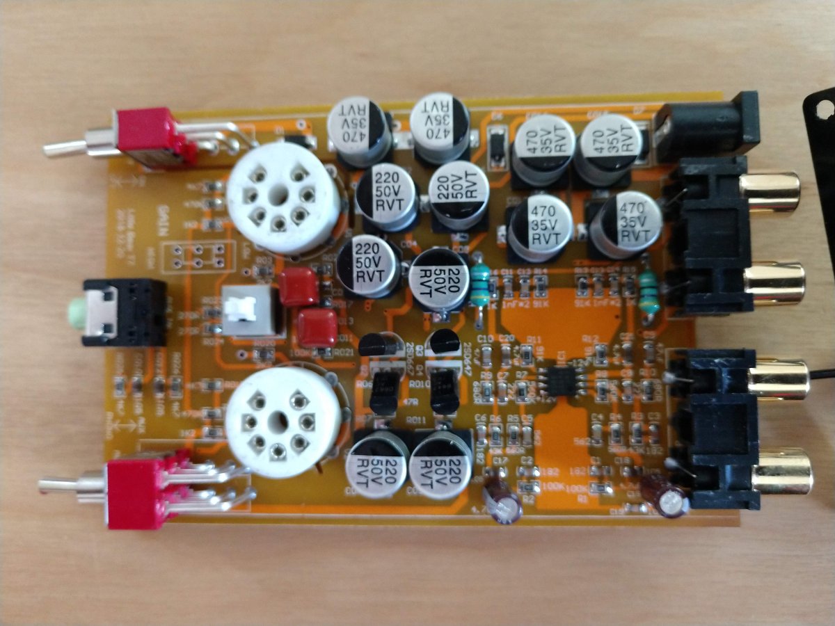
A little ChiFi tube-type RIAA phone preamp.
I have been fooling around with this little 6AK5 preamp. I find it works very well and sounds better than the built-in phone preamp on my Kenwood VR-309. The FU-29 tube amp did not come with a phone preamp.
This is a short video clip of an audio processor at one of our transmitter sites. The fancy lights around the control knob are designed for the program director. They are saying “Buy me… Buy me…”
I was talking to a friend from Russia about history, my job, and various other things that are going on in my life. I received this reply, which I thought was interesting on a number of levels:
I’m glad we are on the same page about the era of the ‘cold war’. We were interested in your life even more than you in ours. We had almost no sources of information except for ‘The morning star’ which is a newspaper of the Communist party of Great Britain. The Voice of America and the Liberty (or Freedom, I have no clue because for us it was ‘RADIO SVOBODA’) were extremely hard to tune on. All foreign broadcasts were jammed. So to listen to the station you should maximize the volume up to the limit which was dangerous. Soviet houses are not at all soundproof and your neighbors could easily rat on you. Since that time I’d been dreaming of a small radio with could receive a clear signal from abroad. Of course we have the Internet broadcasting now but they often use old recording instead of live air and the signal depends on your data carrier. You should be online, you should have an app and unlimited data on your contract, your phone should be charged all the time. Too many conditions. Unfortunately a lot of foreign sites are banned here and the trend is to make this number bigger and bigger.
I find that perspective interesting. We take for granted our ability to listen to information and listen to different points of view, even those we don’t agree with. There are still trouble spots in the world and some people are not as fortunate. It is very easy to block internet traffic and there are several countries that currently block access to some or all of the internet, for the safety of their citizens, no doubt. Ideas are dangerous.
In the last ten to fifteen years, many large government shortwave broadcasters have reduced or eliminated their programming favoring an internet distribution model. This is a mistake. It is very difficult to successfully jam terrestrial radio broadcasts. Shortwave Facilities are expensive to develop and maintain, there is no doubt about that. However, as the Chief Engineer from Radio Australia (ABC) once told me “HF will get through when nothing else will.” Ironically, ABC has eliminated its HF service on January 31, 2017.
It seems to me that a sort of “Shortwave Lite” version of broadcasting might be the answer. Use more efficient transmitters with lower power levels closer in to the target areas. Such transmitters could be coupled to rotatable log periodic antennas to target several listening areas with one system, thus greatly reducing the number of towers and land required. Solid-state transmitters with a power of 10-50 KW are much, much more efficient than their tube-type brethren.
DRM30 (Digital Radio Mondiale) has not gained widespread use in the MF and HF bands. Like its HD Radio counterpart, the lack of receivers seems to be one of the adoption issues. As of 2017, there are only four DRM30-capable receivers for sale not counting software plug-ins for various SDRs. That is a shame because my experience with DRM30 reception has been pretty good. I have used a WinRadio G303i with DRM plug-in, which set me back $40.00 for the license key (hint for those nice folks at the DRM consortium; licensing fees tend to quash widespread interest and adoption).
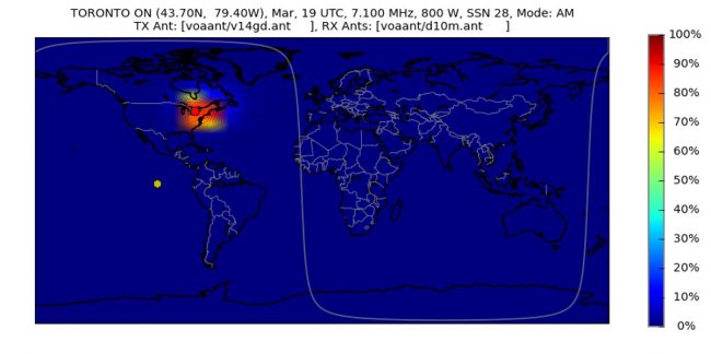
CFRX, Toronto coverage map, average HF propagation conditions
Finally, I have advocated before and still advocate for some type of domestic shortwave service. Right now, I am listening to CFRX Toronto on 6070 KHz. That station has a transmitter power output of 1 KW into a 117-degree tower (approximately 50 feet tall) using a modified Armstrong X1000B AM transmitter netting a 15-32 µV received signal strength some 300 miles away. That is a listenable signal, especially if there is no other source of information available. The average approximate coverage area for that station is 280,000 square miles (725,000 square kilometers). That is a fairly low overhead operation for a fairly large coverage area. Perhaps existing licensed shortwave broadcasters should be allowed to operate such facilities in domestic service.
The point is before we pull the plug on the last shortwave transmitter, we should carefully consider what we are giving up.
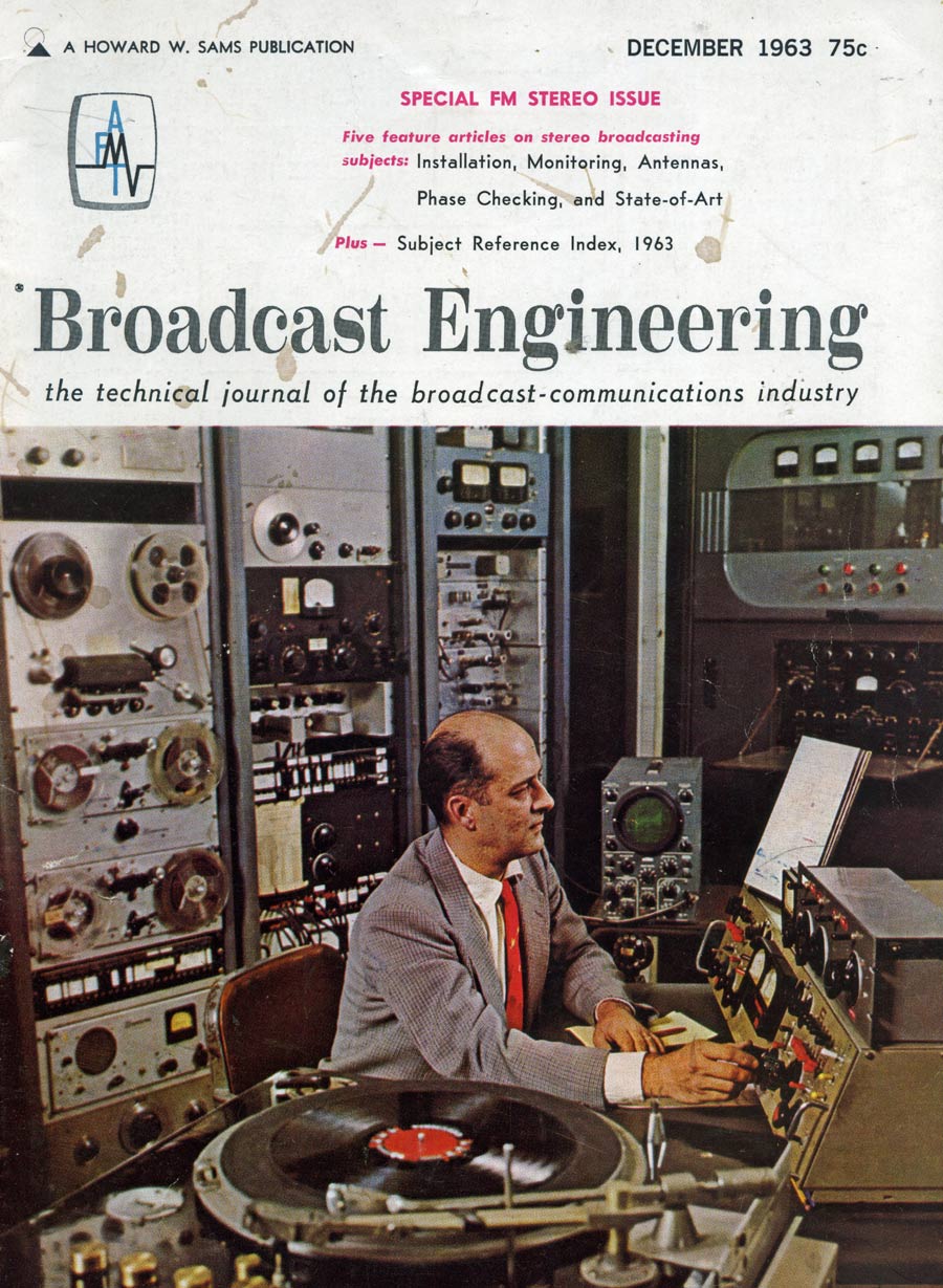
This is a reprint of an article by the same title first published in the December 1963 “Broadcast Engineering” magazine; volume 5, number 12. By George W. Yazell:
In planning a new installation, the broadcast station engineer will be called upon to evaluate the products of various manufacturers before an order is placed for new FM stereo station equipment. In preparing his recommendation, the engineer will review descriptive literature, advertisements, and instruction books. He will seek information and advice from his consultant, other station engineers with stereo experience, and sales representatives of broadcast equipment manufacturers. His thinking may also be influenced by magazine articles and advertisements.
It is unfortunate, but true, that during the engineer’s survey he will encounter many conflicting opinions and claims. Some “advisors” may go so far as to imply that their system of stereo signal generation is the only one worthy of consideration, and all the rest have so many shortcomings as to be impractical or even unworkable.
The simple truth is that any manufacturer offering a transmitter or associated device for sale to broadcast stations must obtain FCC type acceptance. In doing so, complete and authentic test data is submitted for the Commission’s review and approval. Type acceptance by the FCC is your assurance that the equipment will meet certain specifications.
Thus you can either draw straws, or accept the views of the “advisor” with the most forceful opinion and still feel safe that the equipment you recommend will work. A more practical solution would be to prepare a list of equipment and features you require, with careful attention to needs peculiar to your own station; then select the equipment which most nearly matches your requirements.
List What You Have
The first step is to list and evaluate any equipment, facilities, and assets already available for the proposed installation – even if it is only a construction permit, a bank account, and a plan of operations. Some items to consider include:
Ask management for a budget. This is probably the most significant factor in your recommendation. You should set both a practical budget and an absolute top limit. If you find it impossible to do the job within the budget limitations, do not hesitate to say so. Point out that stereo is a two channel system and that in addition to special transmitting equipment, the studio installation will require two of each amplifier, loudspeaker, telephone line, etc. Therefore, a stereo installation will cost considerably more than monophonic facilities.
Review the program plans for the station. The quantity, complexity, and flexibility of the audio equipment selected must adequately meet these needs, with some reserve facilities for future expansion.
You may presently have an FM, AM, or TV station a combination of these. In this case you can probably count on using existing studio facilities, some of the technical equipment, the tower, remote control facilities, and technical manpower.
Consider the abilities of your technical staff. You may be the only engineer, or may have available a large staff of technical personnel. In any event, select equipment having circuits and components your technicians can install and maintain.
Survey the supply situation. Determine the location and stock capabilities of electronic supply houses in your area. Keep in mind that any electronic component must eventually fail; and an inexpensive component can cost hundreds of dollars if you are “off the air” several days while a replacement is being flown in from a distant source of supply. If the supply picture is discouraging, you can best protect yourself by selecting practical equipment employing readily available components – and ordering an adequate supply of spares for parts you cannot obtain locally.
List your needs
Your next step is to prepare as complete a list as possible of the total equipment requirements.
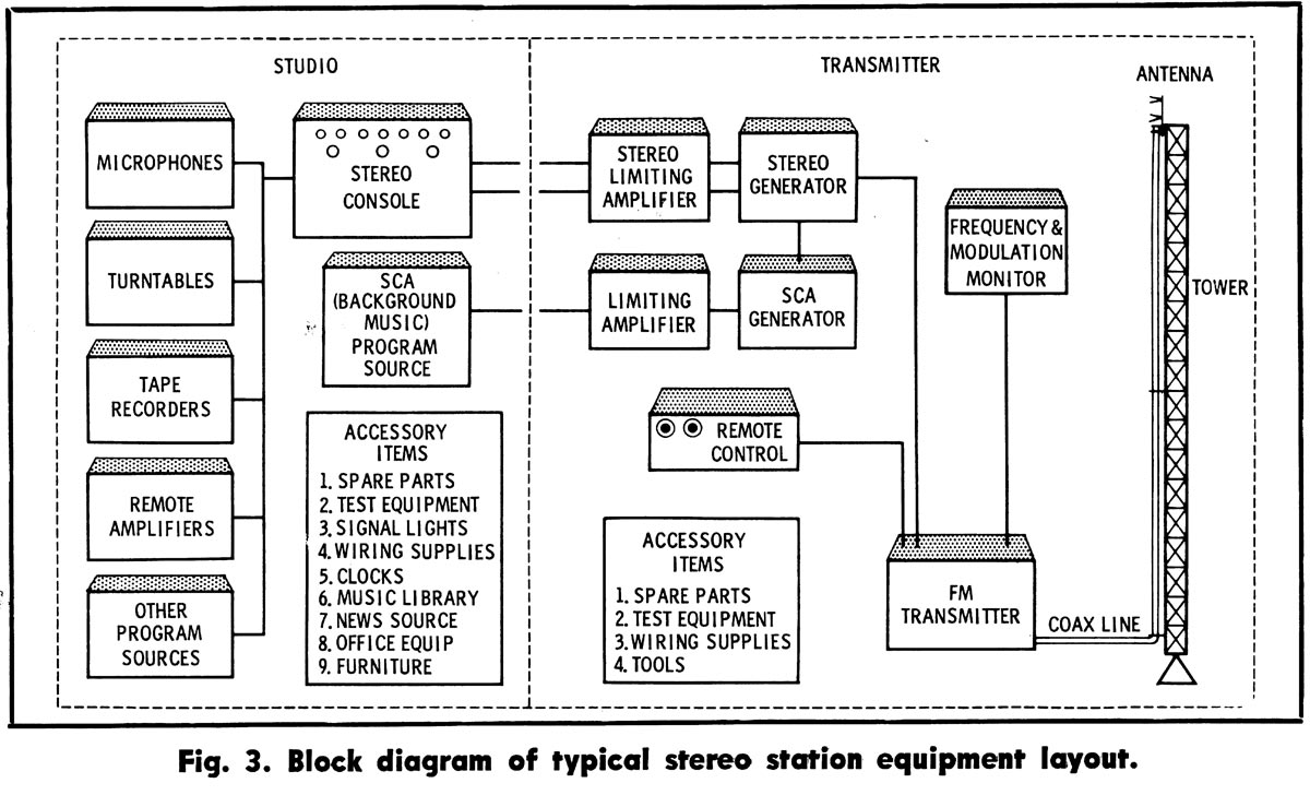
Broadcast Engineering, Typical Stereo Diagram
Sketch a block diagram of your proposed layout (Fig. 3). Then prepare a chart of all the equipment you will need with space provided for prices, data, and notes on each device. As you prepare these charts several things will become evident:
You will probably discover more equipment is needed than you originally anticipated.
In determining what must be purchased, you must carefully integrate your needs with the equipment now on hand.
Your ultimate decision will depend on many interacting factors rather than on one outstanding feature of a particular device.
It will be wise to purchase as many items as possible from a single source to take advantage of: the compatibility of equipment that is designed to work together as a system, coordinated shipments and service, possibly lower cost because of quantity purchase, and -if required- simpler finance arrangements.
Making a Decision
After considering the points outlined above, and making the lists, you are ready to select equipment.
If the budget is limited you may investigate the possibility of some used equipment. However, since today’s FCC Stereo Specifications were only established as recently as 1961, there will be little used equipment available. In the majority of cases, converting old monophonic equipment will be difficult, and costly, and the end result may be less than satisfactory. Old “dual channel” audio consoles have been successfully converted, but the process usually requires almost complete rebuilding. It is necessary to install dual faders, correct phase differences, and balance gain between channels.
Used FM transmitters are frequently advertised, but many are left over from the early days of FM. Some transmitter manufacturers of the late ’40s are no longer in business. Replacement tubes and parts are difficult, if not impossible, to get. Some older transmitters lack stability and some contribute to the degradation of stereo separation because they do not maintain the proper phase relationship between upper and lower sidebands. If such a transmitter is to be used, it probably will be necessary to purchase a new exciter and, of course, a stereo generator.
Since stereo listeners are a discriminating and critical audience, audio equipment should be chosen with care. It will be wise to settle for only the finest professional stereo turntable and tape equipment. It is better to have the minimum requirements of excellent equipment than a control room crowded with “make-do” items.
Stereo consoles are available with a wide range of prices and facilities. Some offer stereo channels only for record and tape inputs, while the more complete models even make provision for stereo networks and remote circuits. Much of today’s programming is on records and tapes, but regional “off-the-air relay” stereo networks are springing up. Stereo microphone facilities are a must if you want your locally produced commercials to sound as impressive as your stereophonic music.
Current models of FM transmitters are highly efficient, trouble-free, and easily remote-controlled. All FM transmitters follow one pattern- a basic exciter and a number of amplifier stages to produce the required power output. The power amplifiers in the various models are somewhat similar, except in high-power transmitters (20 kw and up).
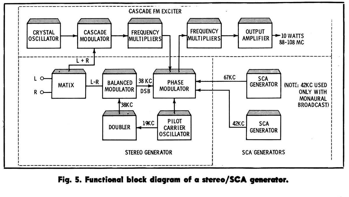
A wide variety of FM exciters and stereo generators is offered, and this is one area in which confusion might occur. (Again, it should be pointed out that all these units are subject to FCC-type acceptance.) A typical exciter and stereo /SCA generating system is shown in Fig. 5. The block diagram explains the signal path and function of the various circuits.
Broadcast Engineering, FM stereo exciter diagram
Conclusion
The selection, installation, and operation of FM multiplex stereo equipment require the careful attention of a highly skilled technician. Installation, adjustment, and maintenance should be in exact accordance with the manufacturer’s instruction book. Following these instructions, the broadcast engineer can feel confident in planning a stereo installation that will be a pleasure to operate and a source of pride and profit.
I found a stack of these old Broadcast Engineering magazines from the early sixties when cleaning out the WUPE-FM (formerly WNMB) transmitter site. I thought it would be interesting to see how Broadcast Engineers some 50+ years ago were planning for FM stereo. One of the stations I worked for, WRVE (formerly WGFM) was the first station in the country to broadcast with the General Electric stereo system. This was later adopted as the standard for FM stereo broadcasting in the US.
Another one of those former ATT Long Lines sites has been re-purposed. This site was known as Rock City and as the name suggests, it is a fairly remote location. These locations were chosen by ATT to facilitate microwave relay between cities. Some of the more remote rural locations are so far off the beaten path that they do not make good wireless carrier sites today. Such is the case here, there simply are not enough people around to turn this into a profitable cell site.
Former ATT long lines site, Rock City, NY
This site is useful in other ways, the local township purchased it and has put it to use for E911 dispatch and other uses such as WKZE translator W290BZ.
Former ATT long lines Western Electric Tower, Rock City, NY
The tower is less than 200 feet tall, therefore it is no longer painted or lit. These old Western Electric towers were really built. Under that peeling paint, the galvanizing is still in near-perfect condition. The tower dates from 1968.
Former ATT tower, Rock City, NY
The Western Electric KS-15676 microwave antennas and waveguides have been removed. The top platform is quite large, one could build a house up there. The W290BZ antenna is the cross-polarized LPA attached to the center pole which is barely visible.
Former ATT long lines site, Rock City, NY. The big empty.
This room held the switch gear and TD-3 microwave radios.
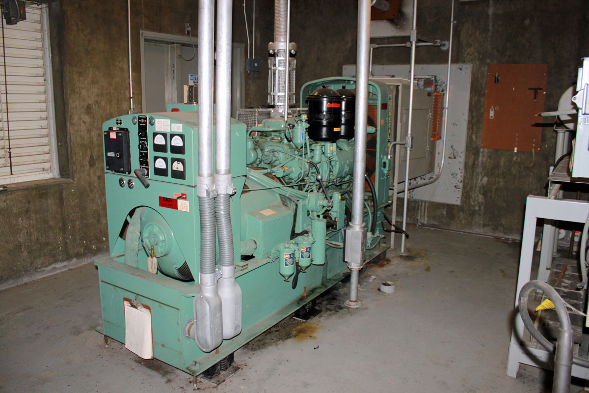
Former ATT site, Rock City, NY 100 KW generator
The original General Motors 100 KW diesel generator. The fuel tank was removed before the site was transferred from ATT to the new owners. If reconnected to a fuel supply and the block heater turned on, I’d bet this unit would start and run.
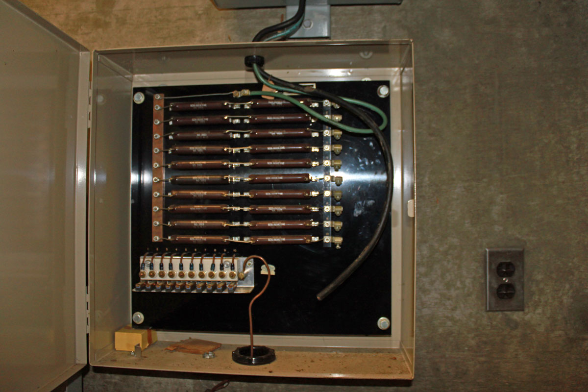
ATT Rock City, NY generator Detroit Diesel straight six engineATT Rock City, NY fuel tank cathodic projection unit.
The tank had a Cathodic protection unit installed, which ran a small DC current through the tank to keep it from rusting.
The original visitor’s log book is still there, showing every ATT person who visited the site from 1968 until it was decommissioned in 1994. This site was unmanned and remotely monitored and controlled from somewhere else. Maintenance personnel showed up at regular intervals or to fix specific problems.
Like many of its rural counterparts, this site sits mostly empty since the microwave equipment was removed in the early 1990s. This one seems to be well taken care of, others are in terrible shape.