WICC WEBE damaged tower removal

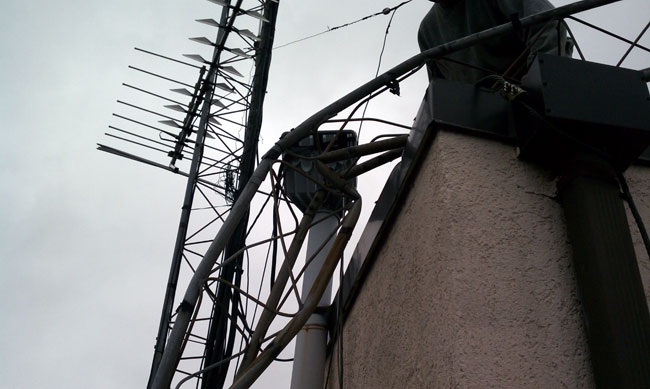
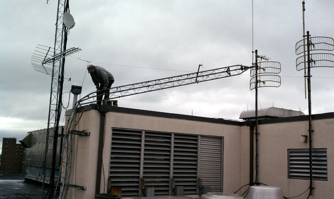
Damaged in last year’s F1 tornado, this thirty-foot Rohn 25-G tower needed to be removed from the roof. It actually went faster than I thought it would, the worst part being moving the 4-foot tower sections down to the salvage truck via elevator. Naturally, the day we choose to do this is the same day that one of the two elevators servicing the seventh floor is out of order.

Damaged Rohn 25G STL tower on roof of studio
Damaged Rohn 25G STL tower on the roof of the studio

This was the same tornado that picked up a twenty-ton rooftop air conditioner and deposited it in the parking lot.  Luck would have it that no one was killed or injured.

Rohn 25G buckled tower section

Using a circular saw with a metal blade, a sawsall and a hand grinder, the tower was cut up into four foot sections.   The sections, brackets, and tower base were taken to the scrap yard and disposed of.

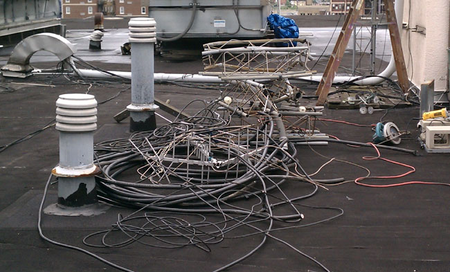
Tower and transmission lines
Tower and transmission lines ready to be removed from the roof

There were several lengths of unused 7/8 inch foam coax, broken antennas, RG-59- RG-58, RG-6, rotor cable, etc that we cleaned off of the roof and tower.

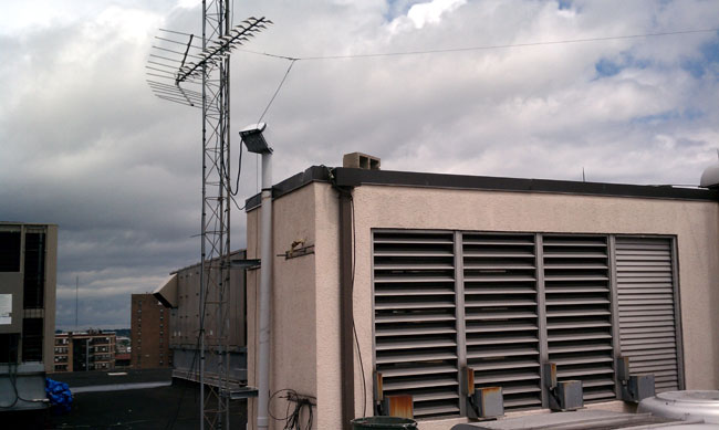
The after picture
The after picture

A good little project to have completed.

The studio build-out for WEBE is also nearly done.  August will mark one year of our company’s involvement at WICC/WEBE.  I was looking around today and comparing the difference between when we started to now.  Many things have been done.

Where are, repeat, Where are all the dead birds?

I am reading up on American Bird Conservancy v. FCC. I must admit, I am a bit ignorant of all this bird v. tower stuff.  After all, in my 25 to 30 years of working in radio, in and around towers almost every day, I have rarely seen a dead bird.  By rarely, I mean I recall seeing exactly three dead birds at the base of towers.  One, a mysterious-looking songbird under a 1000-foot tower in Harrisburg, PA.  Another was a Pileated Woodpecker that flew into a chain link fence.  The third was a half-eaten dead crow that likely met his fate at the hands of the resident Red-Tailed Hawk, who hung out on the tower looking for meals.

Even so, the FCC is going to hold hearings on this important matter, because it is so important.   They also have finished all their other work and have nothing else to do.

According to the website Towerkill.com, millions of birds have been killed because they have flown into communications towers.  In the FAQ section:

Thousands of migrant songbirds killed in a night at a single 1000-foot high television tower

I couldn’t reach BioFile Services, the domain owner, on their cell phones for comment.

I have been to hundreds of tower sites in states up and down the eastern seaboard, California, and Guam.  In all that time, I can only account for one bird that may have died by flying into a tower.  Where are all the other ones?  Surely, when they hit the tower, they fall almost straight down, on account of gravity and the other laws of physics.  That means the terrible carnage would be evident near the base of the tower, right?

The above-mentioned website states that tall towers that are in foggy areas and are lit at night pose the greatest risk.

Case in point:

1. WBNR, which has two 405-foot towers, is located along the Hudson River so it is often fogged in at night.  The towers have four levels of lights with flashing beacons at the 200 and 400-foot levels.  The site is also on a major N/S migration route for birds.  Further still, it has a lawn extending 200-300 feet from the base of all the towers.  This was the former studio location from 1959 until 1998.  In the ten years, I worked there, I did not see one dead bird, nor did the tenant that lives in the building.  No employees who worked at the former studio location recall seeing any dead birds either.

2.  Mount Beacon, a group of 5 towers ranging up to 300 feet tall near the summit of Mount Beacon, around the 1200-foot AMSL.  Certainly, these towers stick way up into the flight paths of migratory birds.  One tower is lit at night with a red beacon light and it is often foggy.  The area around the base of the towers is gravel/dirt and cleared away for at least 100 feet.  Still, no bird carcasses.  Nearby, however, there is a group of Bald Eagles, which have taken up residence in some of the craggy rocks.

3.  Illinois Mountain, Highland, NY: Same story

4.  Clove Mountain, Uniondale, NY: Same story

5.  Mount Zion, Highland, NY: Same Story

6.  Helderburg Escarpment, New Scottland, NY which has towers for the following stations: WRGB, WRVE, WFLY, WYJB, WPYX, WGNA, WMHT, WTEN, and WXXA: Same Story

7.  Mount Equinox, Manchester, VT: Same Story

8.  Pico Mountain, Rutland, VT: Same Story

9.  WHP transmitter site, Enola, PA, six towers 410 feet tall: Same Story

10.  WGY tower site, Schenectady, NY: 620-foot tower, same story

11.  WHP-TV/WITF Harrisburg:  The only place I saw a dead bird was at the base of a tower.

I could continue with the no dead birds found and include tower sites for WROW, WRZN, WDVH, WKZY, WXPK, WLNA, WKBO, WTPA, WIZR, WENT, and so on.

I would testify to these facts under oath.

There may actually be a few towers out there that are located in a position to inadvertently kill birds and that is unfortunate.  The majority of towers, however, are no more deadly to birds than other man-made structures like houses and office buildings.  I can think of at least two dozen times that I have been working in the office or sitting at home and there is a great big “THUNK!”  Outside there is a dead bird under the window.  While that is regrettable, I am not going to take the glass out of my windows.

I also see many dead birds on the side of the road when I am walking or riding my bike.

Human pets, especially cats take a huge toll on wild birds.

Loss of natural habitat from development takes a toll on birds.

This is a Red Herring.  It is time to put this foolishness to bed and get back to the business at hand.
How the Cold War was won

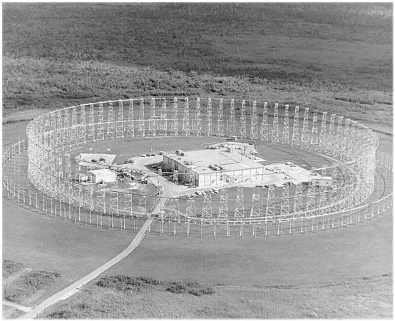
This is not really apropos radio broadcasting, but it is about radio and it has a lot to do with engineering.  Back in the day, as a young man out to do whatever it was, I ended up being stationed on Guam, working at the Coast Guard radio station there.  That was interesting work, to be sure, but every morning and evening, either on my way to or from work, I would drive by this, which looked very interesting:

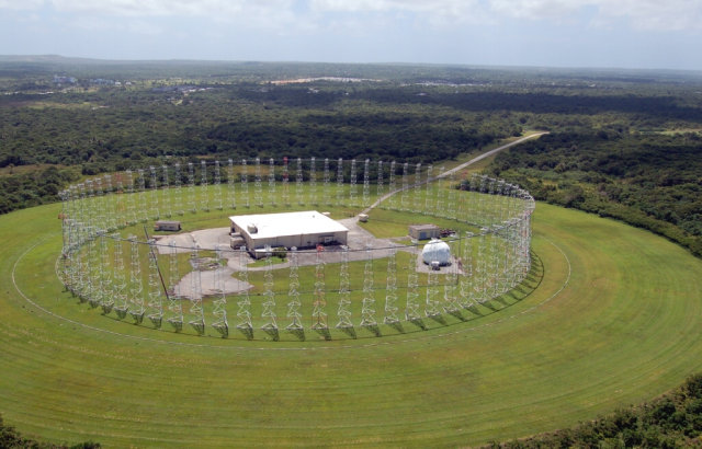
AN FRD-10 NAVCAMSWESTPAC, Guam

I had to lift the photo from a Navy Radio history site.  Back in my day, aiming or even possessing a camera around this area or building would likely inflict the extreme ire of the Marines, who attentively observed the area and were ready to call down a painful lesson to all not obeying the “NO PHOTOGRAPHY ALLOWED” signs.

Nicknamed “The Elephant Cage” it is a Wullenweber antenna used for high-frequency direction finding (HFDF) and was part of a system called “Classic Bullseye.”  There were several of these systems across the Pacific Ocean, and they all worked together using a teletype network.  The Army-Air Force version was called a AN  FLR-9, which was slightly larger.

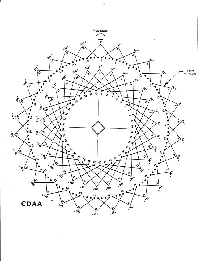
AN/FRD-10 antenna layout

There were two concentric rings of antennas, the tallest being the closest to the center building and used for the lowest frequencies.  It covered from about 1.5 to 30 MHz.  The rings consisted of several individual antennas, all coupled to a Goniometer with coaxial cables cut to identical lengths.  The outer ring had 120 vertical-sleeved dipole antennas, and the inner ring consisted of 40 sleeved dipole antennas.  The inner ring of towers also contained a shielding screen to prevent the antennas on the other side of the array from picking up signals from the back of the antenna.  A radio wave traveling over the array was evaluated and the Goniometer determined the first antenna that received the signal by comparing phase relationships.   The ground system was extensive.  Immediately under the antennas was a mesh copper ground screen.  From the edge of the copper mesh, buried copper radials and extended out 1,440 feet from the building.

The effective range for accurate DF bearings was about 3,200 nautical miles, which equates to about two ionospheric hops with the angle theta between 30 to 60 degrees referenced to the ground.

It was quite effective, it only took a couple of seconds to get a good bearing.  If the other stations on the network were attentive, a position could be worked out in less than 10-15 seconds.

AN FRD-10 transmission line diagram
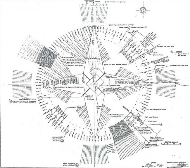
AN FRD-10 ground diagram

It is a little hard to read, but this is the ground layout of the AN FRD-10 CDAA.  The transmission lines to each antenna are shown, along with the ground screen and building in the center of the array.

We Coast Guard types used this mainly for Search and Rescue (SAR) and the occasional Law Enforcement (LE) function.  I believe we actually saved a few lives with this thing.  I found the Navy operators to be very helpful, I think some of them enjoyed the change of targets from their normal net tripping.

The Navy operated AN FRD-10s at the following locations in the Pacific:

  • Imperial Beach, CA (south of San Diego)
  • Skaggs Island, CA (northeast of San Francisco)
  • Hanza (Okinawa) Japan
  • Waihawa, HI
  • Finegayan, Guam
  • Adak, AK
  • Marietta, WA

The Air Force/Army installed AN FLR-9’s in the following Pacific Locations:

  • Missawa AB, Japan
  • Clark AB, Philippines
  • Elmandorf AFB, AK

Basically, there was no corner of the Pacific Ocean that could not be listened to and DF’d.  Some people look back nostagically at the cold war when we “knew who the enemy was,” so to speak.  I am not one of those.  They either didn’t really know the enemy or have conveniently forgotten some of the less endearing qualities of the Soviet Union.

I believe all of these systems have been decommissioned and most have been taken down and scrapped.  The National Park Service studied the Waihawa, HI system as a part of their Historical American Building Survey (HABS HI-552-B2) (large .pdf file) before it was torn down.  Good technical description and building pictures.  Near the end of the report, it is cryptically noted that:

Beginning in the mid-1990s the NSG (ed: Naval Security Group), noting the absence of Soviet targets and wanting to cut costs and change the focus of its SIGINT collection, began closing FRD-10 sites… Undoubtedly, since the September 11, 2001 terrorist attack on the World Trade Center and the Pentagon, listening posts have gained importance and most likely increased in number and sophistication. The FRD-10 CDAA at NCTAMS Wahiawa ceased listening in August 2004; it can only be assumed the closure occurred because there was a better way to do it.

Indeed.

The Guam site has been stripped out and abandoned, the latest photo I can find is from 2008:

Abandoned AN FRD-10, Finegayan, Guam

And people think AM broadcasting is expensive…