With the advent of fiber optic cables starting in the 1980s, the majority (one estimate says 99%) of this country’s overseas communications are carried by undersea cables. These are interesting system constructions, being first redundant and second, self-healing. Glass fiber stands themselves are fairly fragile. Bundling several together and then sinking them in the ocean can create mixed results. Deep ocean bottoms are often very rugged, containing mountains, canyons, and fault lines. Thus the submarine cables used have to be pretty rugged.
There is a common misconception that fiber optic cables do not need repeaters. That is not true, while they do not need as many repeaters as copper cable, repeaters are still required approximately every 40-90 miles (70-150 km) depending on the cable type. These active devices are another failure point. Overall, it is a complex system.
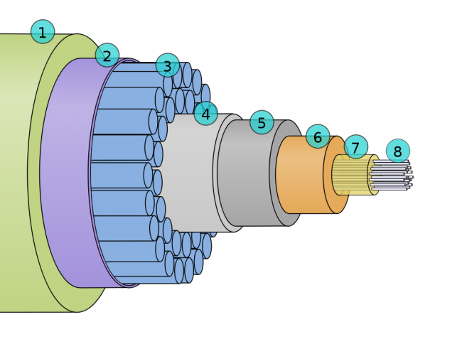
Cross-section of a submarine fiber optic communications cable:
1. Polyethylene
2. Mylar tape
3. Stranded metal (steel) wires
4. Aluminum water barrier
5. Polycarbonate
6. Copper or aluminum tube
7. Petroleum jelly
8. Optical fibers
It weighs about 7 pounds per foot, which is pretty hefty.
There are a couple of interactive maps online that have detailed information about where these cables go, date in service, and data capacity. My favorite is Greg’s Cable Map which is a Google map with cable data overlayed with a downloadable KML file:
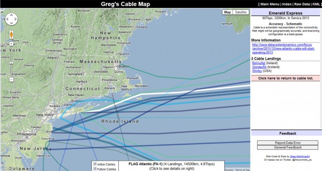
This shows a new cable called the “Emerald Express” which is going into service in 2013. Throughput is reported as 60 Tbps, which is moving right along. As noted on the map, this is more of a schematic diagram connecting two shore side points. The path the cable takes is an estimate and the actual geographical location may (is likely to) be different. Click on any line on the map for cable information. Most cables have their own web page and Wikipedia article.
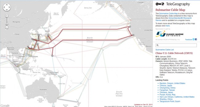
Another undersea cable map is the Telegeography Submarine Cable Map, which has many of the same features noted above:
Just in case you were wondering, as I often do, how a TCP/IP connection is being routed to any given place. For fun, I tried a trace route to a known server on Guam and found the results interesting:
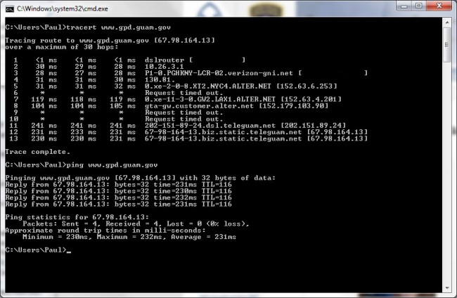
Approximately 231 ms round trip route from NYC to LA to Guam and back, which is over 8,000 miles (12,850 km). A few of the intermediate routers did not answer and I tried this several different times; the same routers time out. This missing information looks to be small steps, not large ones. So, which cable goes directly from LA to Guam? Possibly the China-US Cable Network (CHUS) (picture above). At 2.2 Tbps and landing at San Luis Obispo, that is the likely candidate for the cable that carried my data.
As a general exercise, it is kind of fun, although it may be harder to figure out a particular route to say London or Berlin because there are many more different possibilities.
Route latency is something to keep in mind when planing out AOIP connections for remotes and other interactive type connections between studio and remote location. Almost nothing is worse than that half second delay when trying to take phone calls or banter back and forth with the traffic reporter.
